|
|
Streetscape – an experimental app for urban mapping
- Written by Jonny Aspen
- Tuesday, 27 March , 2012
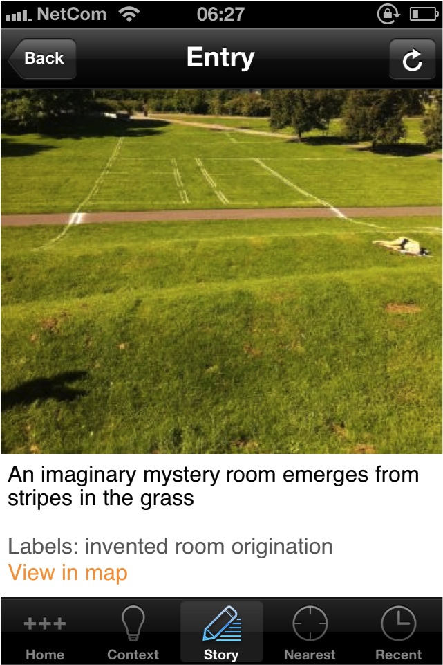
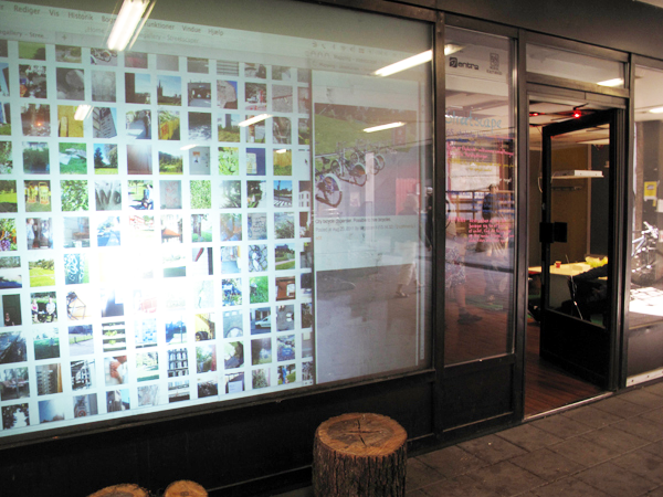
Researchers and developers from the YOUrban project have designed and tested the transposition of the methods of Urban Gallery, via locative and situated mobile media, in a GPS-based app called Streetscape. The app forms the first phase of research into the design and use of social and locative media. It was tested in August 2011 by 60 students of Architecture in a workshop organized in collaboration with the art and urbanism studio Tøyenkontoret. The app was presented on the Local and Mobile conference which took place at the North Carolina State University on March 16-19, 2012.
Until now there has been little exchange between research in locative media and place specific computing that involve ubiquitous technologies and their relations to mapping and design of cities. The intention behind developing the Streetscape app was to explore to what extent explorative mapping techniques and location aware media technologies (such as smart phones) might inform each other.
Urban life is technologically mediated and our technological practices are linked with contexts and uses. Yet we need to investigate how to make the mediated city critically legible through developing tools for mobile literacies that are not just ethnographically inspired legitimations of ubiquitous computing They should be locative enactments that enhance understanding of urban life by moving beyond functionalism and technology determinism towards constructing and situating technologies in relation to cultural settings and practices.
The urbanism inspired methodology of Urban Gallery helps us do that. The Urban Gallery methodology is developed by Chora and Raoul Bunschoten, and explores dynamic principles of mapping complexities of urban space through annotation and indexing that emerge through the application of a set of parameters to spatial contexts.
Streetscape is a designed and trialed application, where experiences from actual fieldwork with students of architecture informs the the second iteration of the app. The development of the app happened in close integration with teaching, and the test of the app was part of the introductory course into urbanism for architectural students, introducing students to reading and mapping urban situations. Since the initial test, students have used the app for further mapping exercises, and a group of master level students are currently conceptualizing future mapping apps.
The diverse composition of the design and research team reflects the cross-disciplinary dimension of the YOUrban project: programmers, designers, researchers from digital humanities and media studies as well as researchers from urbanism and architecture. The design and research team consisted of Peter Hemmersam and Jonny Aspen from the Institute of Urbanism and Landscape, who represented the YOUrban project at the conference, Andrew Morrison from the Institute of Design, Idunn Sem from InterMedia and Martin Havnør from Faster Imaging.
Locale and Mobile
The overall topic of the conference was linking of mobilities, mobile communication and locative media. The conference was the 3rd joint event of the Cosmobilities Network, the Pan-American mobilities network and the 3rd CRDM Annual Research Symposium. At the conference papers were presented on a wide range of issues related to mobility and new and locative media, bringing together researchers from mobility studies, media studies, informatics, social sciences, artists and urbanists.
The conference at North Carolina State University campus (Raleigh, NC) gathered an interdisciplinary group of about 100 researchers from 16 different countries. Keynote speakers at the conference were Paul Dourish (Donald Bren School of Information and Computer Sciences at UC Irvine), Rich Ling (IT University of Copenhagen), and Teri Rueb (Media Study Department at the University at Buffalo).
Even though the scope of the conference was rather wide, most papers presented fell into categories such as locative gaming, empirical mobility studies and locative art practices. In terms of locative apps most attention was given to contexts of gaming (e.g. Shadow Cities), social networking (e.g. Foursquare) and locative art (e.g. L.A Re.play/).
Streetscape represents an attempt to add new modes of feasibility and content to experimental urban mapping methodologies using assets of locative media technologies. It points to the development of new and more place sensitive ways of programming locative media applications by exploiting unused potentials of emerging locative media application technologies.
The experimental mapping approach derived from Urban Gallery differentiates Streetscape from other mapping applications that represent more traditional approaches to map making. As such Streetscape has more affinity to locative art practices than to more traditional GPS/GIS-types of mapping.
The design and use of Streetscape as an urban mapping tool proves promising in terms of exploring mapping procedures and content. It points to ways that locative and social media may find use in, and in turn inform and transform, urban mapping and urban planning as we know it today. We find that there is great potential for further development of experimental urban mapping, street-level urban ethnography, and the use of the app as a device for initializing processes of participation and bottom-up surveying of urban resources.
Planning for Streetscape 2.0 is now underway.
Conference website with videos of paper presentations (forthcoming)
http://crdm.chass.ncsu.edu/mobilities/.
Written by Jonny Aspen and Peter Hemmersam
Post a comment
One Response to “Streetscape – an experimental app for urban mapping”
Pingbacks
- Location and Mapping…Why? | TECHNOLOGY AND INTERFACE on 25 February, 2016 at 06:02


