|
|
Satellite Lamps
- Written by Einar Sneve Martinussen
- Wednesday, 20 August , 2014
We have just launched a new project called Satellite Lamps where we investigate and reveal one of the central infrastructures of the networked city, the Global Positioning System (GPS). This project continues our project of visualising the materials of technologies that started in 2009 with our studies of RFID and WiFi. With Satellite Lamps we now explore the material, spatial and temporal qualities of GPS in cities.
Satellite Lamps is made by Einar Sneve Martinussen, Jørn Knutsen and Timo Arnall. It is both a film that reveals the qualities of GPS in cities, and an extensive online research publication published by the journal Kairos.
GPS is a part of the invisible landscape of the networked city. It is literally one of the largest technical systems ever built, and has become a normal part of everyday life, shaping how cities are being used, navigated and experienced:
Everyday city life is being shaped by the technologies and devices in our pockets, creating new social and spatial practices. These products are made possible by vast technical infrastructures and complex systems that we rarely see and that we often know very little about. GPS is a good example of how these systems are often invisible, often obscure or go unseen, and are becoming increasingly mundane.
To explore how GPS takes place in cities, and how it is shaped by the urban environment, we have designed and developed a series of Satellite Lamps. These lamps contain a GPS receiver and change their brightness according to the strength and accuracy of GPS signals. When we photograph the Satellite Lamps using timelapse photography, the flickering of the lamps show how GPS accuracy fluctuates over time in a particular space.
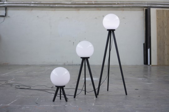
Satellite Lamps trio
The film shows how GPS is not only shaping urban life, but how the landscape of GPS is also shaped by the urban environment. The film shows that:
GPS is not a seamless blanket of efficient positioning technology; it is a negotiation between radio waves, earth-orbit geometry and the urban environment. GPS is a truly impressive technology, but it also has inherent seams and edges.
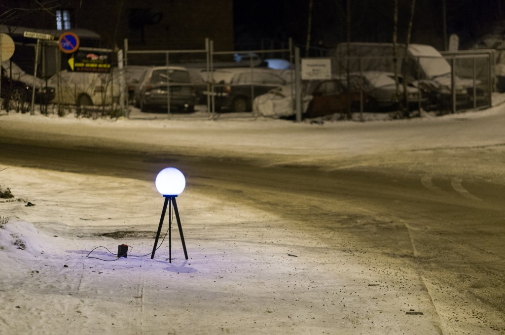
A Satellite Lamp by an Oslo roadside.
Satellite Lamps aims to get at the cultural and material realities of GPS technology, and to develop understandings about networked city life through design.
(…) GPS is a cultural phenomenon shaped by politics, economics, and everyday life, yet it is largely framed as a technological system. By revealing GPS as an everyday, spatial, and highly physical material of our contemporary urban spaces, we point at how technology, culture, economy, and warfare are all intertwined in networked city life.
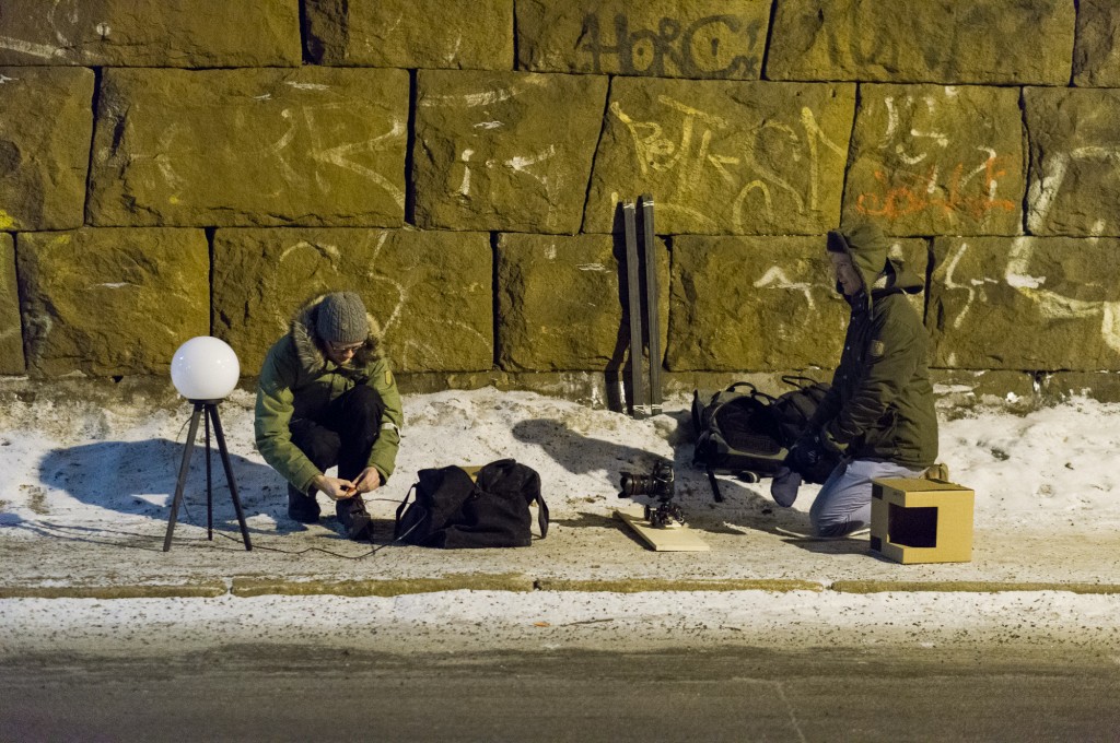
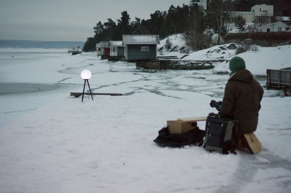
Setting up a time-lapse shot.
Satellite Lamps is a hybrid piece of design research, the film evocatively communicates about GPS in a way that can be seen by many people, while the article we’ve published in the journal Kairos extensively documents our experimental design process, our explorations, production and film work, as well as framing the project through a cultural history of GPS. This form of online research publishing allows us to communicate not only the outcomes of the project, but the detailed trajectory of the process, using images, films, notebooks and reflections. Here, we argue for exploring and communicating design practice that raises issues about the underlying technological materials of networked city life.
(…) we use design not in the traditional sense of finding new or better uses of a technology, but we use the methods, skills, and knowledges within design to understand and communicate about the technology.
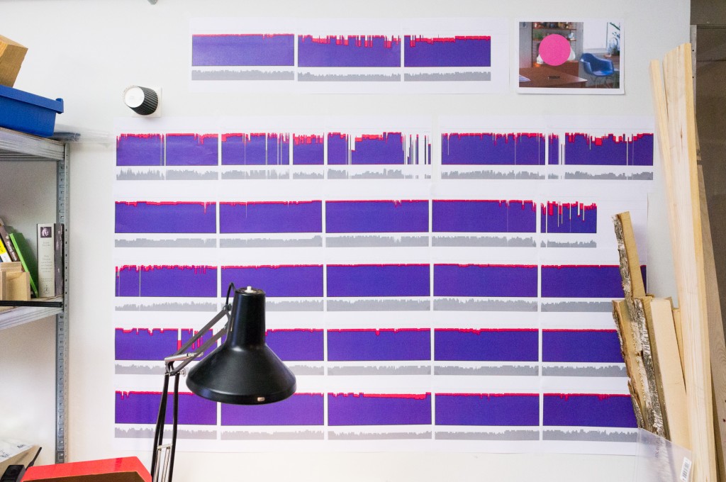
A collection of graphs of GPS accuracy.
The networked city is made up of vast, obscure and often invisible technological systems. With Satellite Lamps we illustrate how interaction design has the technical and communicative means to engage with these complex phenomena. This kind of discursive design makes visible as both celebration and critique, drawing attention to the spectacle of otherwise invisible structures, and opening them up for reflection.
Satellite Lamp getting a stable signal by the Oslo fjord.
Acknowledgements
Satellite Lamps is created by Einar Sneve Martinussen, Jørn Knutsen and Timo Arnall. The project joins together the research projects Touch and YOUrban, and the PhDs of Einar (forthcoming), Jørn (forthcoming) and Timo (Arnall 2014).
Thanks to Andrew Morrison and Jack Schulze (BERG).
Music by Espen Sommer Eide / Phonophani.
More images at Flickr and in the Satellite Lamps publication.
References
Martinussen, E., Knutsen, J. & Arnall, T. (2014). Satellite Lamps. Kairos: A Journal of Rhetoric, Technology, and Pedagogy, 19(1). Retrieved from http://kairos.technorhetoric.net/19.1/inventio/martinussen-et-al/index.html
Arnall, T. (2014). Making Visible: Mediating the material of emerging technology. Phd Thesis. Oslo School of Architecture & Design, Oslo.
Post a comment
2 Responses to “Satellite Lamps”
Pingbacks
- Arduino Blog » Blog Archive » GPS lamps and the (in)visible landscape of the networked city on 9 October, 2014 at 18:42
- GPS lamps and the (in)visible landscape of the networked city | Linux-Support.com on 9 October, 2014 at 19:15